

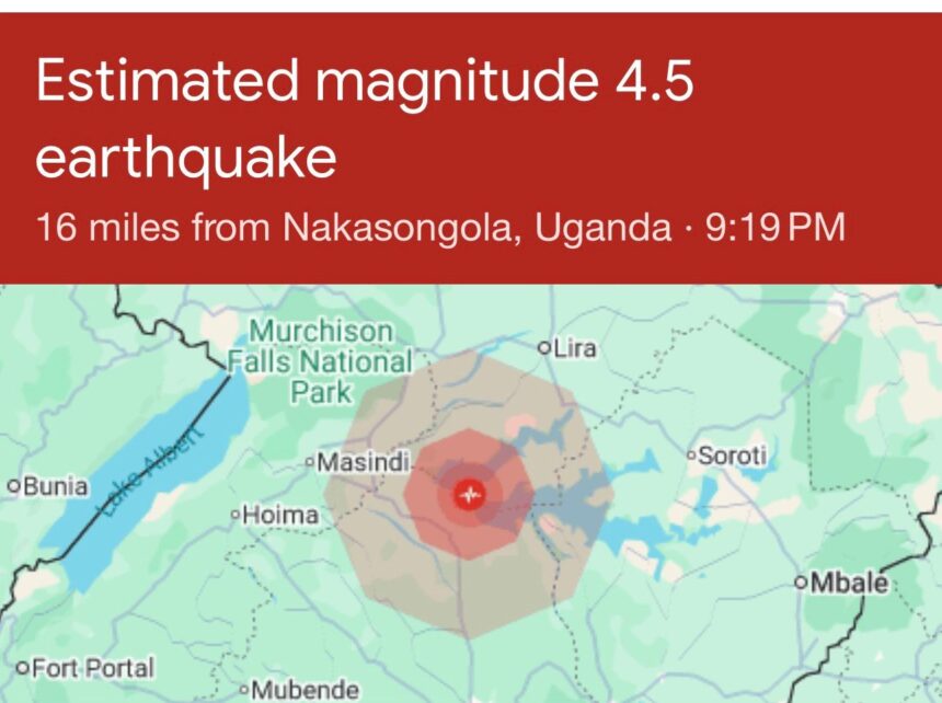
Residents of Nakasongola District in Uganda’s Central Region reported feeling earthquake tremors on [today’s date], with the shaking lasting several seconds and prompting panic in homes and markets.
Nakasongola, a township of about 6,900 people located roughly 124km north of Kampala, lies in an area classified as “Medium” earthquake hazard by hazard mapping agencies. The district sits near the Nakasongola Discontinuity, a major geological suture between southern and northern crustal blocks in Central Uganda.
At the time of filing, Uganda’s Department of Geological Survey and Mines had not released official data on the tremor’s magnitude, depth, or exact epicenter. Local reports indicate the tremors were felt strongly enough to cause residents to rush outdoors, but there were no immediate reports of structural damage or casualties. Authorities have urged calm while assessments continue.
Context: Uganda’s seismic activity
Uganda experiences earthquakes due to its location between the eastern and western arms of the East African Rift System. While most quakes are small, magnitude 3 or below, the country averages about 7.5 quakes per year and has recorded at least 11 quakes above magnitude 5 since 2000. ba3f9957
Nakasongola has felt tremors before. Historical records show earthquakes within 150km of the district, including a M4.3 event 144km west on April 8, 2023 and a M4.5 quake 148km west in April 2019. A previous earthquake report noted Nakasongola as one of the towns that contributed reports when tremors were felt across the Kampala region. 028f 028f
The most destructive recent quake in the region was the 2016 Tanzania M5.9 earthquake near Bukoba, which killed 4 people in Uganda’s Rakai District and collapsed dozens of houses. Uganda’s strongest recorded quake remains the 1966 Toro earthquake at M6.6, which killed 104 people in Uganda and damaged buildings as far as Kampala.
Preparedness concerns
Experts warn Uganda remains vulnerable due to rapid urbanization and substandard building stock. The government launched the SERENE project with the Global Earthquake Model Foundation in April 2026 to strengthen seismic safety, building codes, and disaster preparedness. The project aims to produce Uganda’s first national seismic risk map to inform planning.
Disaster officials have previously said Uganda’s Emergency Coordination Centre lacks funding, equipment, and personnel to handle major disasters. The Ministry of Energy and Mineral Development maintains 5 seismic stations at Entebbe, Hoima, Nakauka, Kilembe and Mbarara-Kyahi to monitor activity.
Response
Nakasongola District officials are yet to issue a formal statement. Residents have been advised to avoid damaged structures, check for gas leaks, and be prepared for aftershocks, which commonly follow seismic events in the Rift region.
NNAfrica will update this story as the Uganda Department of Geological Survey and Mines releases technical data on magnitude, epicenter, and impact assessment.
_Developing story. Last updated EAT_[time]
Email Us on editorial@nnafrica.com